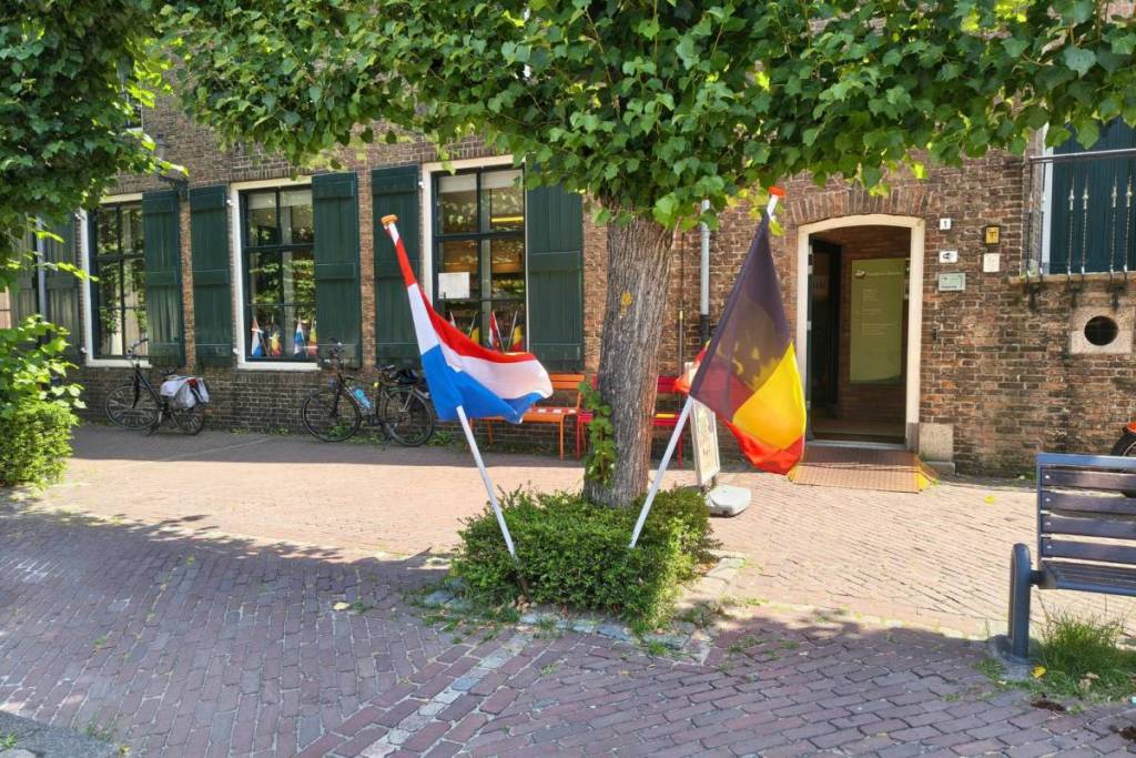

An hour and a half from Amsterdam, deep in the North Brabant border region, visitors walk through a geographical enigma. On a single shopping street, pedestrians unknowingly cross the international border sixteen times.
That unique border village is Baarle-Nassau and Baarle-Hertog. The foundations for this world-famous enclave structure were laid as early as 1198 through a clever medieval feudal agreement.
Centuries later, border conflicts turned this local agreement into an unsolvable puzzle.
An international jigsaw puzzle: 30 enclaves and 7 rare counter-enclaves
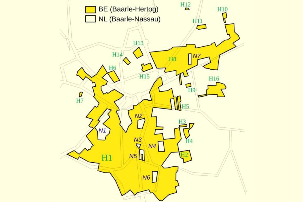
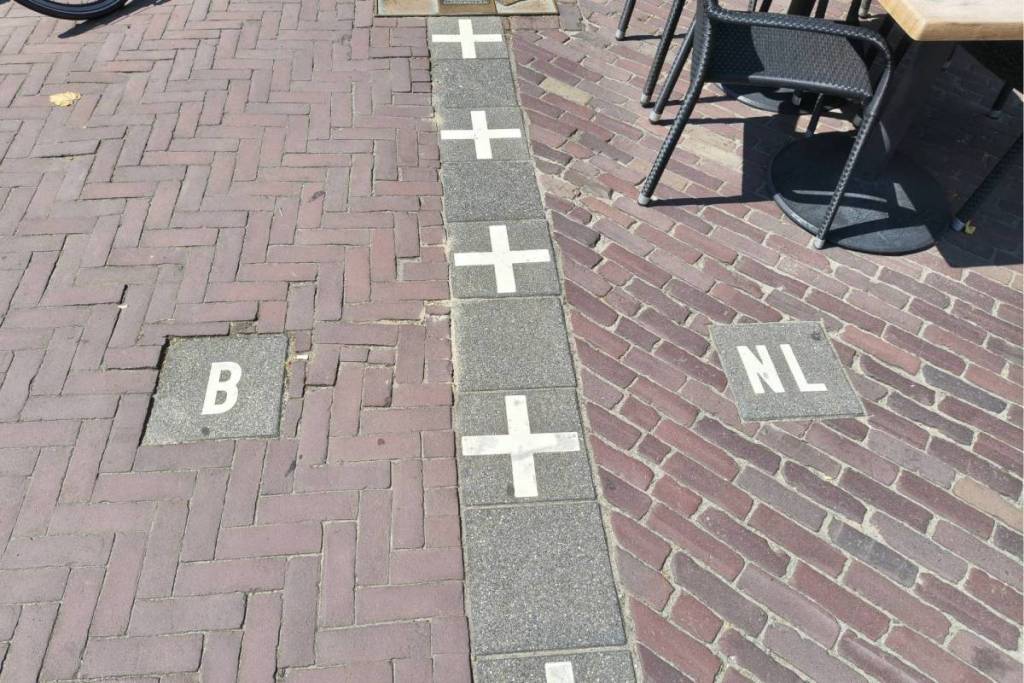
Anyone who simply walks down the main shopping street crosses an international border no fewer than sixteen times within a few hundred meters. White sidewalk tiles and zinc pavers on the asphalt crisscross to mark the exact boundary between the Netherlands and Belgium.
The village has 22 Belgian enclaves in the Netherlands and 8 Dutch exclaves. Seven of these are rare counter-enclaves: small pieces of Dutch territory within a Belgian enclave on Dutch soil.
It is no coincidence that this bizarrely complex map was ever drawn this way. Just as with the many historic fortified towns and defensive structures in our country, this is the direct result of a medieval power struggle.
From a medieval feudal agreement in 1198 to the border treaty of 1843
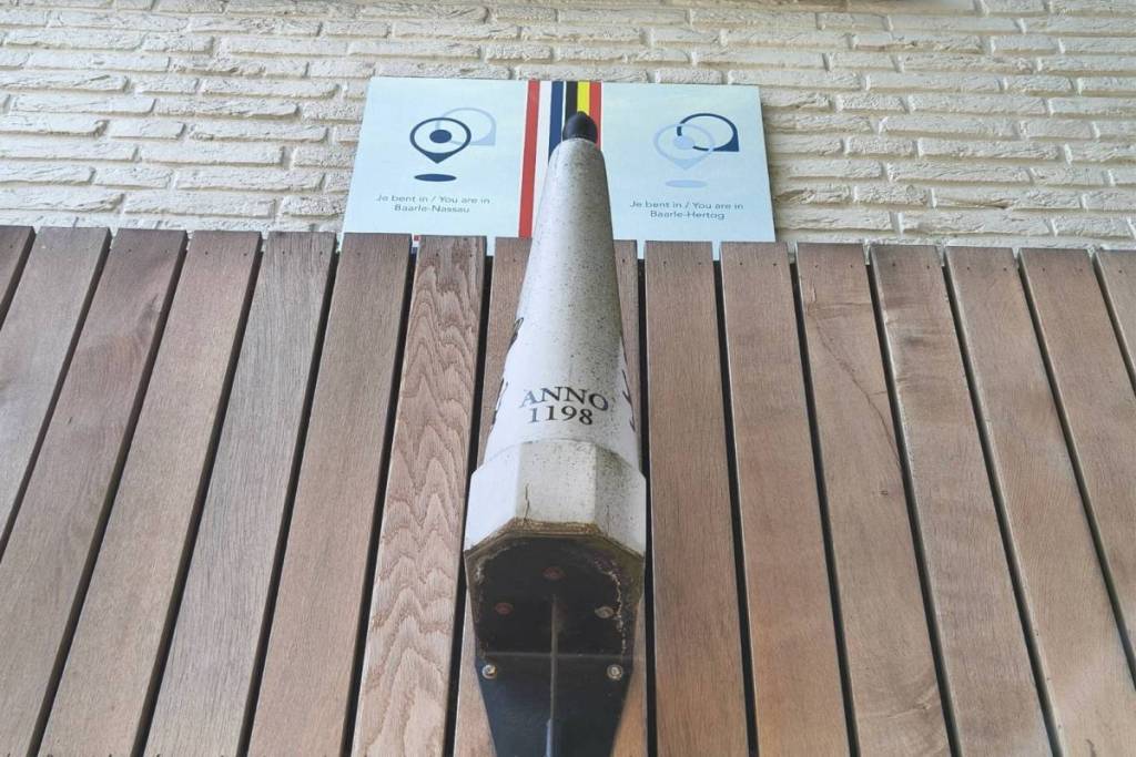
In 1198 , Henry I of Brabant formed a clever alliance with the lord of Breda, Godfrey II of Schoten. The duke retained the inhabited, taxable lands (Baarle-Hertog), while the uncultivated lands fell under Breda’s jurisdiction (Baarle-Nassau). With the Peace of Münster in 1648, this medieval leasehold structure suddenly transformed into a rigid international border between two hostile powers.
In 1843 , border commissioners attempted to straighten out the line between the Netherlands and Belgium. However, the historical intertwining of the two countries proved so complex that they left the border open. That geopolitical“hole in the border” led to bizarre situations during the occupation of Europe in the twentieth century.
Unoccupied during wartime: why Germany did not enter the enclaves
During World War I, Germany occupied Belgium but could not enter the Belgian enclaves in Baarle without violating neutral Dutch territory. As a result, Baarle-Hertog remained a free island.
The Allies took advantage of this loophole: a secret radio station was set up in the enclave to relay intelligence to the Yser Front. In response, the Germans built the infamous “Death Wire”— a deadly electrified fence —around the enclaves.
Two house numbers, two flags: the bizarre border laws of Baarle
In Baarle, the official “front door rule” determines your tax residence: the country onto which the front door opens determines your official address and tax rate. Does the national border run exactly through the front door? Then the building gets two different house numbers and doorbells (one for the Netherlands and one for Belgium).
It wasn’t until 1995 that the Baarle Joint Committee mapped out the jagged border down to the centimeter. What once began as medieval fragmentation is now a unique symbol of European cooperation.